From the top of our street, there is one peak which
always dominates the view – Mount Barrow. It’s not far out of town, is covered
in snow for a good portion of winter and frequently blanketed in cloud.

View of Mount Barrow from a month or so ago
Ryan has attempted the drive up once before, but had to
turn back because the road was too slippery (I believe it was also snowing at
the time…). Given a rare, sunny day with the peak visible, we decided to try
the drive again.
It’s an easy 10km from the main road to the Mount Barrow picnic area, but then another 4km or so to the top along a narrow, exposed dirt
road (reminiscent of Jacob’s ladder).
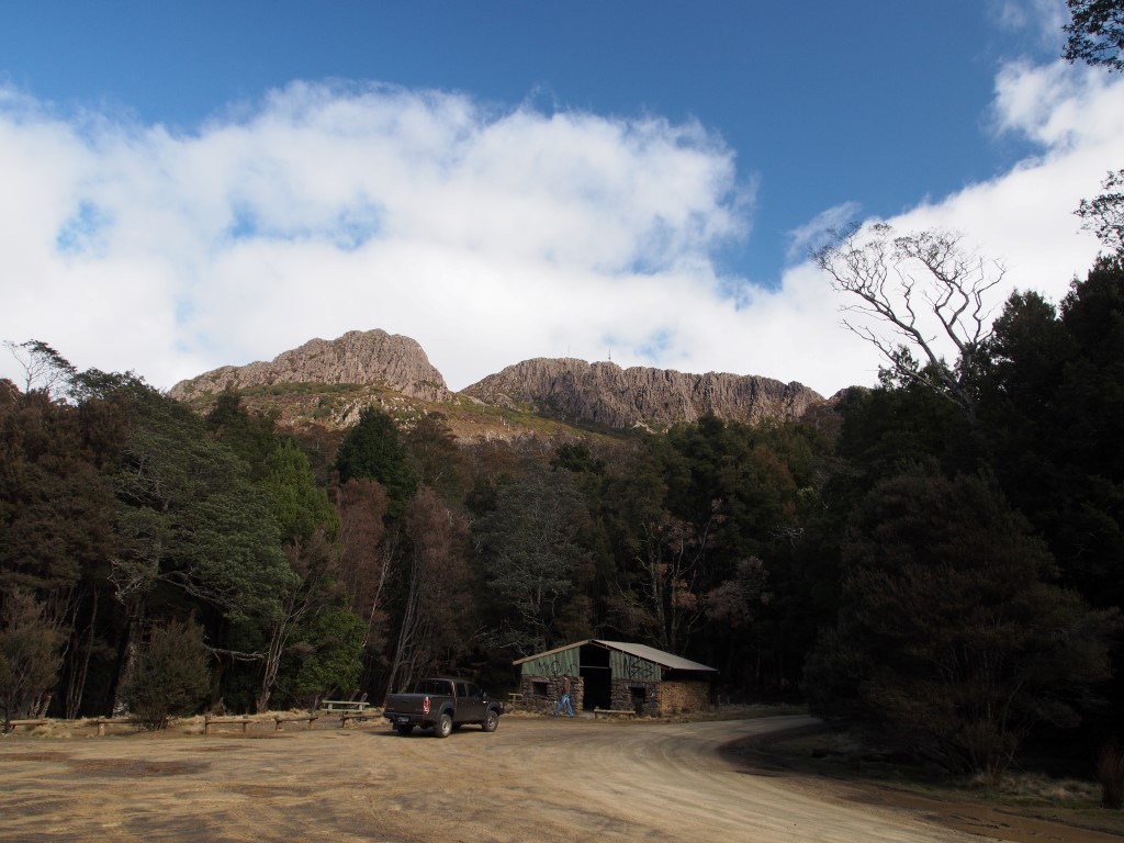
Mount Barrow picnic area

It gets a bit more hairy towards the top
The road continues from a parking area, along the plateau to
an antenna array, but is closed to traffic, so we left the truck and walked the
rest (hoping to find a good view south for coming back at night to spot the
aurora). No luck with the view south (blocked by mounds of rock), but we did
manage to get a pretty awesome view over Launceston (and the Tamar River all
the way to the coast) by scrambling along a boulder field to the edge of the
plateau.

Walking along the road

To find all of this, but no view south

Boulder-hopping to get closer to the edge of the plateau

To get this view over Launceston
(can't really see it well in the photo, but the whole town is pretty much visible)

This is the reason we walked on the rocks
(the vegetation was like one giant swamp)
There was also an excellent view from a shelter adjacent to the main
parking area, taking in the coastline, as well as the last, winding section of
road.


We made it safely down, then decided to head back “the scenic
way”. I managed to navigate us into a maze of forestry roads, which eventually
spat us out somewhere east of Lilydale and added about 80km to the trip. I
called it exploring and in keeping with the spirit of adventure. Ryan was not
impressed…
No comments:
Post a Comment