Sunday, July 19, 2015

Penguin and the Dial Ranges

Having another work-free weekend (where both of us were actually in the state at the same time), we packed up the tent to join my parents again, this time in Penguin.

After sharing lunch in their caravan, we went for a drive out to Leven Canyon. We had visited here once before in April, but the scenery was markedly different this time, with a fresh dumping of hail covering the road-side verge and low clouds over all the hills.

Hail on the grass

Still addicted to photos of fungus...

Misty and rainy canyon

At least the rain meant there was plenty of water in the river

Heading back to the carpark

We're both obsessed with trying to get the perfect shot of these tiny bell-shaped fungi
(spotting them in the undergrowth is half the challenge)

On the drive back out, we stopped briefly at Preston Falls - a quick 5min walk from the road leading to a viewing platform over the waterfall as well as the valley below (now hidden in rainclouds).


We then headed back to the caravan to dry out, and enjoyed a few rounds of post-dinner Rummy (the game, not some weird Tasmanian alcohol)

Quick roadside stop to photograph the clouds over the hills

Ryan got up early the next morning to take some photos of the sunrise (with his vantage point over the ocean being literally just outside our tent). 


After breakfast, we checked out the Penguin Markets before heading up into the Dial Ranges. Our original plan was to do a short walk in Ferndene Reserve, but after finding a questionable-looking teenager lounging in his car at the trailhead (with his ugg boots out the window), we decided not to leave our car at his mercy and drove on a bit further to walk up Mount Gnomon instead. I had read that the first part of this track was steep, but the rest not too bad, so I managed to convince my parents to tackle the climb. Either the track-notes were wrong or my recollection was a bit off, because it turned out to be a moderate climb all the way to the top (oops).

At least there were lots of pretty distractions along the way


Our objective - Mount Gnomon

Let the record show that the track is practically flat
(never mind the camera's failure to capture steep gradients)

More fungus
(I know, this is now bordering on pathological)

(Part of) the view from the top
(overlooking the ocean and the town of Ulverstone)

It was a little chilly

She had no idea...

Mossy Tasmanian forest

With still more colourful fungi

After descending back to the car, we drove back to (the now deserted) Ferndene Reserve, and went for a pretty (albeit muddy) walk along the creek to a couple of old abandoned mine tunnels. 

Lots of BIG tree ferns

And you guessed it - more fungus


Browning's tunnel - this one went back about 10 metres before ending in what looked to be a cave-in
(according to my Dad, who hid inside in the muddy darkness, waiting to ambush us when we caught up)

There was more than just moss and fungus in the forest...

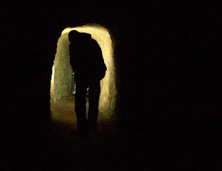
Thorsby's tunnel - this one was much longer, and went about 30 metres into the hillside

Before ending in a steel grate, with a deep shaft on the other side
(this is my Dad throwing rocks down the shaft to see how deep it goes...)

The tunnel was reasonably big, just not quite tall enough for Ryan
(who is walking away with the torch and leaving me behind in the dark...)

And began with a steep scramble down a slippery, muddy bank at its entrance

Lots of stops on the way back out
(we are now officially slower hikers than my parents)

Yet another unique fungus - this one is called Geastrum, which translates to "earth star"

We dropped into the Maker's Workshop in Burnie (where hand-made paper is made)(with the paper of the day including the ingredient wombat poo...), then enjoyed afternoon tea together in the caravan before bidding my parents (temporarily) farewell and heading back to Launceston.

Canada - Day 12 (Canmore - our last official day)

Last day in Canada :-(

Rachael had been doing some indoor rock-climbing in Canmore and was keen to have a go outside, so we arranged a rock-climbing trip for the morning. We found a local company where we could hire a guide for a few hours - they provided the equipment, we provided the transport, and we scored our own personalized climbing experience.

I'm not entirely sure where exactly we climbed, but it was about 20min out of town. A short bushwalk took us to some low cliffs, where from the top, we could see east over the plains (being right at the edge of the rockies).

Setting up
(or, more accurately, standing around while our guide sets up)

We spent the morning clambering up the rocks, working our way from the easiest pitch to some more challenging (for us) climbs. Rachael remained wary of the wildlife, and there was a moment when she was belaying for me (ie. holding the rope that kept me from falling to a certain death), when there was an ominous rustling in the trees immediately behind her. Let's just say that it was a little precarious for a few seconds, as I clung to the rock while she decided if she was going to drop the rope and run for her life...

She's smiling here because she hasn't yet realized that she is about to be eaten by a grizzly

Being 6'4 is a definite advantage

If the mountain-biking hadn't destroyed her legs, this was sure to finish them off...

Rock-climbing squirrel

For the afternoon, we headed back to Banff to check out Sulphur Mountain. The 5km walk to the top was tempting, but there were some ominous-looking black clouds rolling in, and with thunderstorms predicted, we decided to take the soft option and ride the gondola up.

Once on top, there was a boardwalk along the crest of the mountain to its highest point, where an old weather station still perched at the mercy of the freezing wind. The views were (as expected) amazing, with a 360 degree vista over the town of Banff in one direction and the snowcaps in every other.

Overlooking Banff

Storm clouds over the weather station

Walking back down towards the gondola

It may have been a little bit windy

With a few hours of daylight left, we finished the day by driving to Johnston Canyon. Rachael had already been there twice before, both times in the winter. One of these visits had required crampons and several hours of slow trudging up the ice-covered path past frozen waterfalls. For us, the weather was mild and the water was roaring through the canyon, fresh with snowmelt. Rachael couldn't believe how relatively short and easy the walk actually was (without all the snow and ice to contend with).

Alot of the track was on boardwalks skirting the canyon wall
(Ryan and Rachael are in the distance)

Lower falls

View from inside the cave seen in the photo above
(the water is roaring past just outside, couldn't get any closer without drenching the camera)

Walking further upstream
(you would be correct in thinking that I was constantly being left behind while I took photos)(story of my life)

Upper falls

Sunset through the trees

We rounded out the day with dinner together in Banff, and dropped Rachael back at home with a sad goodbye (although I suspect she was probably glad to have a bit of rest in our absence...)

Not much to say about the following day(s). We drove the final stretch from Canmore to Calgary, leaving the snowcapped rockies (sadly) behind. Our flight departed just after lunch on Friday to bring us finally back to Launceston on Sunday morning (with the pilot welcoming us home by announcing that the outside temperature was a balmy 1 degree....)

Looking back, I think the highlight of the trip for me was the amazing scenery, particularly along the Icefields Parkway and on our hike above Lake Louise. I've quizzed Ryan on his highlight, and although he can't choose one particular thing, he says his biggest disappointment was not seeing anyone get eaten by a bear. Sigh.

Saturday, July 18, 2015

Canada - Day 11 (Canmore)

Rachael now had two days off, so determined to fit in as much adventure as possible (doesn't sound like us I know), we headed to the Nordic Centre for some mountain-biking. This was the site of the cross-country skiing for the 2010 1988 winter olympics and was now full of all sorts of fun bike trails for use in the summer.

We rented mountain bikes and headed off for some exploring (with the promise of more bear sightings from the rental shop staff)(but interestingly, no recommendations regarding bear spray/avoidance/how to stay alive in general).

We started with the "orange loop" (once we eventually found it after missing the trailhead and unnecessarily riding up a BIG hill). This consisted of some pretty nice single-track which took us mostly through the forest, but also across some open grasslands with the mountains towering above. Rachael managed to take a slow-speed tumble over her handlebars, which we missed, but she captured nicely on her GoPro (unfortunately also cracking the casing in the process).

Mountain-biking with a view

Rest stop

The video evidence

After stopping for lunch (and patching up Rachael)(she was only bleeding a little bit...) we attempted the "adrenaline trail". Despite following the suggested trail direction from the map we'd been given, it seemed like we ended riding mostly uphill (including several sections of trail that were clearly designed to be ridden in the other direction). By the end, poor Rachael was not only bleeding, but also completely exhausted. Wonder why no-one wants to come mountain-biking with us???

Also, no bears, but we did spot a large deer and a few more squirrels.

The "ice-cream bus" in Canmore provided some much-needed refueling (an old school bus parked in the middle of town, converted into an ice-cream shop), then we went for a late afternoon drive up to Spray Lakes. Rachael's previous job in Canmore had been with a dog-sledding company, and she showed us the spots where they used to run their tours alongside the big Spray Lakes reservoir.

Spray Lakes
(or, more accurately, one Spray Lake I guess)

The reservoir

More zombie-sheep by the road-side

View on the way back down 
(with the falls we had walked to the previous day in the trees on the right)

After stuffing ourselves silly at dinner (well deserved after spending most of the day riding), we went for a walk together up the ominously-named "cougar creek" which runs close-by to Rachael's place. It had a massive wire fence spanning the valley at one end, designed to catch boulders in the event of flooding, but much more reminiscent of Jurassic Park (with the forest above looking perfect for hiding dinosaurs).

Walking in cougar creek with the three sisters in the background
(Ryan has dubbed this shot "the five sisters")