Back to Canada…
Thursday was a driving day. We left Whistler (still
without seeing Whistler Mountain itself which remained hidden in the clouds) and
headed north towards Kamloops. The drive was spectacular. I took so many photos
of snow-capped mountains through the windscreen, not realizing that we would be
completely surrounded by them in a few days time.

One of many peaks along the way
Every point of interest was signposted and
we made several stops to do short walks and take photos. The first was Nairn
Falls, where an easy 1.5km walk took us upstream along the river to where the
falls were roaring through the rocks (good time to see waterfalls when all the
snow is melting). We actually encountered a snake on the way back, and did the
only sensible thing – stopped and took lots of photos :-)

Nairn Falls

Of all the man-eating animals to be concerned about in Canada, I didn't think I would need to be on the lookout for snakes...
Our next stop was Joffre lakes. There was the option of hiking through the valley to see several lakes in the chain, but
with a long way still to drive, we elected to take a short walk just to the
banks of the first.

First lake
We pulled in briefly to a roadside stop next to Duffy
Lake, which was jammed with logs at one end, and reflected the distant snowcaps
at the other.

The view north - logjam

The view south - Hyundai ad (our hire car)
Following a lunchstop in Lillooet, the landscape began to
open up, and we found ourselves driving through open valleys flanked by steep,
rocky slopes.
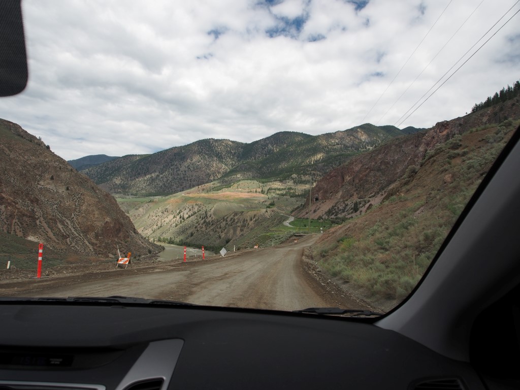
Change in scenery

And weather
Our final stop was at Marble Canyon. This wasn’t really much
of a canyon, but another clear blue-green lake fringed with reeds.

Rather than staying overnight in Kamloops, we decided to
continue on a little further to Sun Peaks resort (recommended by Kevin and
Jill via Frank). This was a cute little ski village (a smaller,

View from our window

Sun Peaks streets (clearly very busy)

Apparently this helps with the man-flu...