Monday, June 29, 2015

Intermission (Corinna weekend)

I'm afraid it's taking me so long to write about Canada, that we've started having Tassie adventures in the meantime. I'm therefore interrupting the usual Canada update to tell you about our weekend :-)

We decided to head over to the (as yet unexplored for us) West Coast and Tarkine. Although distances between places in Tassie don't seem too great, driving anywhere takes ages and Saturday was no exception. Happily, though, driving is half the fun. We started off in rolling farmland, then winding roads through dense forest, then low alpine scrub with views of the distant mountains.

Our one target for the outgoing leg of the trip was Philosopher's Falls, located just west of Waratah. We reached these via a short walk (about 1.7km each way) through the rainforest, pausing often to photograph the colourful fungi.


The track then followed along the old water race (as well as over it and occasionally in it)(bit muddy) before descending a steep metal staircase to a viewing platform next to the falls.

The track on the embankment next to the water-race

Walking on the water-race itself

Philosopher's Falls

The climb back out

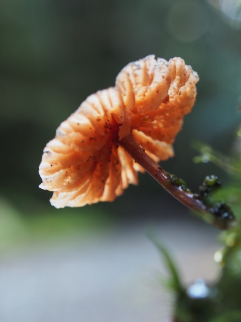
So much trouble for such a little mushroom (many, many shots from different angles, different exposures, different focal lengths...)

From there we continued our drive to Corinna where we would stay for the night. We were hoping to catch the sunset from a peak nearby, so we raced to check in as the sun rapidly descended towards the horizon. We couldn't find the walk we wanted to do (Longback) but ended up driving "just a bit further" and "a little bit further" north along the beginning of the Western Explorer Road and managed to find the perfect sunset-viewing parking spot (which we enjoyed along with the complimentary cheese and crackers from Corinna).


Corinna itself is an old gold-mining town. The surviving buildings (like the old pub) have been turned into accomodation (along with some new cottages), making it the "Corinna Wilderness Experience". We stayed in a miner's cottage (new made to look old), and enjoyed a peaceful evening in front of the gas fire (once Ryan recovered from the devastating news that there was no phone reception or internet).

Our cottage 

The pub by night

The following day we woke to overcast skies. We just managed the short Huon Pine boardwalk along the riverbank before the rain started. So we ousted the barge-man from the warm, dry pub and got him to ferry us across the river in the rain (it struck me as slightly humourous that the ferry across the Pieman River is called the Fatman Barge...)

Perfect reflections on the river

Huon Pine walk

Our target for this leg of the trip was Montezuma Falls, northeast of Zeehan. More driving. We took a short detour out to the coast at Granville Harbour, where the day all of a sudden (temporarily) turned sunny.

This shot looks like it belongs to an entirely different day

The paper map I was following (I know, an actual paper map) showed a 4WD track to the falls and we found the turn-off easily enough. This was signposted with warnings that the 14km track was impassable after heavy rain. It was, by this time, raining steadily again (technically not "heavy" rain...), so we decided to give it a crack. We made it about 2km before things started turning alarmingly muddy, so rather than get stuck in the middle of nowhere we elected to turn around (no mean feat for a track that was exactly one car-width wide with dense bush on either side).

Taken on the way back after turning around (ie it got much worse than this...)

The more conventional access to the falls was via a much more benign, mostly tarred, 2WD-friendly road. From its end we kitted up in our rain-gear, and walked along the old tramway to the falls (about 5.5km each way). Apart from the fact that the track was a consistent width and followed a gentle grade through several cuttings, there were other clues as to its origin in the form of old sleepers and an old moss-covered and partly collapsed bridge. The falls themselves were roaring, and we were misted with spray (as well as rain) as we enjoyed the view from the precarious suspension bridge that spanned the canyon below.

Preceded by a sign saying "if you look carefully, you might be able to spot some of the old sleepers..."

Montezuma Falls (and a wet camera)

Look Mum, no hands


Never walk past some good fungus

Old decaying bridge

Messing around in the creek below the bridge

Then all that was left of the weekend was the three-hour drive to get home again...

Tuesday, June 23, 2015

Canada - Day 4 (Whistler)

So it turns out that climbing two mountains in one day will result in subsequent muscle pain, achingly tight calves, and the inability to walk down stairs. Luckily mountain-biking involves a whole set of (mostly) different muscles :-)

It was severely tempting to join the throngs of body-armour-clad downhill bikers hurtling their way down the mountain, but given the fact that only the lowest chairlift (of three up the mountain) was open and the better than even likelihood of me causing myself significant injury, we decided to stick with cross-country riding in the valley. So we rented a couple of bikes, received a few trail suggestions from the shop-staff and headed off to have some fun.

We spent the morning playing on the lake trails. These were good, but it seemed hard to get any kind of flow happening because we found ourselves constantly being spit back onto various fire-trails, then having to pause and reconsider which way to ride next. Despite being pretty much hopelessly lost after a couple of trails, we managed to inadvertently piece together an almost perfect loop around the park.

Nice sections of flowy trail

The dangers of extreme photography
(apparently lining up the perfect shot can induce spontaneous nosebleeds)

Lots of bridges to ride

The rock that (literally) stopped me in my tracks

We enjoyed lunch at the base of the gondola, watching the downhillers shoot out from the trees at the bottom of the mountain. The peaks themselves remained shrouded in cloud and there were even a few skiiers lining up with the bikers, taking advantage of the remaining snow somewhere far above.

Looks deceptively quiet in this shot, but there were bikers everywhere


True to our (my) habit of choosing the most difficult-sounding trail available to us, I pored over the trail map at lunch and settled on the "Flank Trail" for the afternoon (based on the fact that it was the longest and highest track on the map). We rode out to the trail head along the paved Valley Trail then got temporarily lost trying to find the beginning of the actual trail. We had to resort to asking for directions in a bike shop, and I managed to startle the three guys inside who didn't notice my entry by calling out a hearty "G'day"...

After being pointed towards the (now fairly obvious in hindsight) trailhead (which we had ridden past three times), we found the track climbing pretty much straight up the side of the mountain. We pedaled/puffed/pushed our way up, then followed the trail along the flank of the mountainside. There were a few vantage points which gave us good views back towards Whistler village across the valley, but most of the time we were riding through forest. Bear warnings had been abundant at the beginning of the trail, and although we questioned every strange noise emitting from the forest (and a few big piles of poo along the trail), the bears remained invisible, and we remained un-eaten. The trail eventually dropped us back into the valley, and after just over 40km of riding, we were officially cooked for the day.

More bridges
 
Enjoying the view (and resting the legs)

Saturday, June 20, 2015

Canada - Day 3 (Vancouver to Whistler)

We decided to bid farewell to Vancouver by taking on the (aptly named) "Grouse Grind" - a 2.9km gut-busting ascent of one of the peaks overlooking the city. This was STEEP and unrelenting and mostly made up of giant uneven stairs (which were probably perfect stepping height for Ryan, but a bit of a challenge for the rest of us mere mortals...). There was a timer system set up (which you had to pay for)(we didn't), and Ryan had already scouted their website to find out the best time of the morning (50-something minutes). He probably would have come close, if it wasn't for me pausing to take frequent photos (as an excuse to allow my palpitating heart some respite). In the end, we puffed our way to the top in 1hr 7min.

It starts off friendly enough


And then goes straight up...

And up...


The top of the mountain was clouded in, so no views to reward our effort. We did, however, enjoy watching the 2 resident grizzly bears in their enclosure on the peak (contained by not much more than a wire fence)(which allowed us to get enticingly close)(I'm sure the bears were thinking the same thing). The walk was one-way, so we took the mandatory gondola ride back down (filled with the aroma of a dozen other sweaty walkers), catching glimpses of the city between the clouds along the way.


Looks kinda cute till you see his claws

By this method, Ryan has determined that he could probably take on a black bear, but a polar bear might be a bit much...


We enjoyed one last lunch with Frank, then loaded up the rental car and bid him farewell. To Frank (if you happen to read this) - you are one of the most generous and hospitable people we have ever had the pleasure of staying with. Thankyou for sharing your home (and your city) with us :-)

Because the Grouse Grind wasn't punishment enough, we also had our sights on climbing "The Chief" - an imposing stone bluff overlooking the town of Squamish which we would drive past along the way to Whistler. We tackled this in the afternoon - another lung-searing 3.5km climb (and 3.5km descent - no gondola this time). There were three peaks to climb (each being successively higher and further away), with most people ascending the first. We walked all the way to the base of the second, then found a series of questionable-looking ladders and chains leading up the rock. I quickly lost my nerve and decided that I wasn't particularly keen on falling off the side of a mountain that day, but Ryan carried a bit further along enjoying spectacular views over Squamish.

More climbing

Squirrel of the day


The sign at the base of the second peak clearly warns that the ladders are not "official" and that it would be your own stupid fault if you died while trying to climb them...


We then backtracked and climbed to the top of the first peak (involving much more solid-looking ladders and chains and a final scramble up the steep granite face). This peak afforded panoramic views of Squamish and the valley below. We also marveled at a couple of dogs that made the climb up with their owners (I think it's awesome that dogs are allowed in a lot of the parks in Canada)(I would totally have a hiking dog if I lived there).

The view is alright I guess...

Looking over at the second peak from the first

Pretty cascade on the way back down

This is what happens when Ryan gets bored waiting for me to finish messing around with the camera (nice photo though)


Feeling decidedly more weary, we completed the rest of the drive to Whistler and checked into our hotel, then rewarded ourselves with a dinner of bison steak and peanut butter pie :-)

Canada - Day 2 (Vancouver)

We spent our second Vancouver morning at Lynn Canyon (as a free alternative to the much more touristy Capilano Suspension Bridge). Lynn Canyon had it's own small suspension bridge, which overlooked a nice waterfall cascading down the canyon directly below our feet. We walked upstream through the mossy woods, and spent some time marveling at the crystal clear water flowing though the shallow creek above (well - Ryan and Frank "marveled" patiently while I messed around with the camera to get some watershots...).

View of the falls from the bridge

View of the bridge from the bridge :-)

Little people amongst the big trees

One of many watershots...

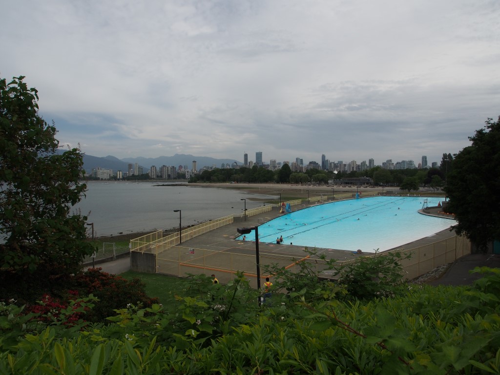
From there, we embarked on "Frank's official driving tour of Vancouver - Part 2: Southside". This took in a different perspective of the harbour and the cruise-ship port, and the very "touristified" (yes - it is a word) Gastown. We drove past Frank and Lloyd's old house and visited Kitsilano pool and beach. Lloyd's bench with its memorial plaque was in the park above the pool, and from there we could see over the bay to Frank's apartment building in the distance (reinforcing how awesome a location it's in and how lucky we were to be staying there). We completed the drive all the way out to the end of the bay and ate a late lunch at the University golf club before making our way back again.

Pool with a view


My mission for the evening was to spot a raccoon, so Ryan and I embarked on another foray into Stanley Park. I am disappointed to report, however, that despite walking along both the "Squirrel Trail" and "Raccoon Walk" we saw none of either. In fact, at that point in time, the most abundant form of Canadian wildlife we had seen were giant, colourful slugs... 

Should the forest catch on fire, I guess this would be the place to be??

BIG trees

This sucker was a good 20cm long and thicker than my finger

Saturday, June 13, 2015

Canada - Day 1 (Vancouver)

This entry is brought to you from 40,000 feet somewhere over Idaho…

We started our official exploration of Vancouver the best way possible – on bikes. And started with the most obvious destination – Stanley Park (just up the road from Frank’s place).This was our first taste of Canadian forest, with its massive trees, dark, mossy interior and the occasional squirrel. Ryan and Frank also spotted an otter scampering across the rocks into the sea.

Totem poles in Stanley Park

Bike path around the park

We extended the ride by continuing along False Creek. It was fun to see all the other people out riding, walking, running and rollerblading, and the whole waterfront precinct was beautiful.

Obligatory photos with the "laughing" statues out the front of Frank's place (we watched people do this all day from the 14th floor)(and couldn't help ourselves)

After lunch, Frank took us for “Frank’s official driving tour of Vancouver – Part 1: Northside”. We stopped at the base of Grouse Mountain (one of the peaks overlooking the city), but elected not to take the (moderately expensive) gondola to the top, instead hatching a cunning plan to come back and hike the trail up. We also saw the Cleveland Dam and drove up Cypress mountain (enjoying the view back over the city on the way up).

Snowcaps in the distance over Cleveland Dam

View from the dam wall

View over Vancouver from partway up Cypress Mountain (the greenery at the right-hand side of the bridge is Stanley Park)

From there, we dropped into Horseshoe Bay (where the ferry departs for Vancouver Island) and followed the coast back to Whytecliff Park, with a final stop at a small rocky outcrop set at the bottom of a pretty little street that Frank had discovered by accident, but has become one of his favourite stops. From there we enjoyed views of the big container ships coming in and out of the bay.

Vantage point in Whytecliff Park

And the track to get there

Watching the ships from Frank's secret spot

After all that driving, we were planning on rewarding ourselves with a world-famous Stanley Park chocolate milkshake (well – Craig had one there once and said it was the best he had ever tasted)(it has now become a thing of legend). I guess his claim will have to remain unchallenged, because (much to our thirsty disappointment), the cafĂ© there no longer sold them. We settled instead for ice-cream and coffee (no prizes for guessing who got which).

The view we could have been enjoying over chocolate milkshakes...

Sunset from Frank's place

Dusk (taken about 10.30pm)

Canada - Day 0 (the travel day - doesn't really count)

So I’m currently sitting in Calgary airport and I’ve decided that instead of wasting time waiting for our plane, this would be the perfect opportunity to finally update the blog (although it probably won’t get posted just yet). You’ll have to forgive me for not posting anything sooner, but I’ve been too busy having fun :-)

Canada has been awesome. I’m officially in love with the snowcapped Canadian Rockies. And chipmunks. And possibly also brewed Canadian coffee topped up with cream.

Not much to say about the first day. Our flight from Melbourne was delayed after they had to offload us all to fix the electrics on the plane (pretty much turned it off and turned it on again), so we missed our connecting flight from LA to Vancouver and got to enjoy the wonderful LAX airport a few hours more than is necessary (actually, any hours are more than is necessary)(that place is dreadful).

In happy contrast, Frank’s place in Vancouver was AMAZING with its 14th floor panoramic views of English Bay (as all the Clements who have made the Vancouver pilgrimage well know)(seems to be a Clement rite of passage). We went for a stroll along the waterfront and enjoyed the changing light from 14 floors up as the sun eventually set over the bay (with the realization that the sun doesn't set until about 9.30pm - means lots of long days for adventures to come).

Proof we made it

The waterfront

The view by day...

And by night