Monday, November 15, 2010

Post-script

Oh - and we did finally manage to get our new tent. As you can see - it is quite a bit bigger than our little dome tent (Ryan can actually stand up inside, as well as lie full length without poking his toes out the zipper :)

And yes - in case you were wondering, we DID set it up in the loungeroom.

Now we just have to schedule another trip so we can properly try it out - and the weather promises to give it's water- and wind-proof properties a proper workout. We had another tropical storm last night - one lightning strike was so close that it set off all the fire alarms in the building complex. This resulted in a visit from a truckload of firefighters, and the air-conditioning hasn't been working since. Wonder if the tent comes with lightning rods???


Posted by Picasa

The trip home

We were tossing up several possibilities for our drive home - maybe down through Hall's Creek and via Wolf Creek Meteor Crater (loooooong drive, not sure which roads were open), maybe via Gregory National Park (same story with the roads and probably needed more time to explore the place properly) or maybe just overnight in Katherine.

In the end we decided to head back towards Katherine, but to see the Flora River Nature Reserve along the way. This involved a detour of around 50km each way from the highway on a road that would become closed as soon as the wet season set in. The campground at the end looked very much abandoned, overgrown and neglected - maybe they had decided to close down already? Our original plan to camp there overnight suddenly seemed a little less attractive.

The main attraction of the park was a series of cascades in the river where dams of tufa had gradually built up over time (deposits of calcium carbonate which had slowly accumulated and solidified over plant debris in the river). There were two main falls, but views of both of these were obscured by the vegetation along the riverbanks. We could only get tantalizing glimpses of cascading water through the foliage, and weren't brave enough to venture right to the edge, where shady, still pools looked very likely to contain crocs. The water itself was a beautiful clear blue-green (due to the sunlight reflecting off dissolved crystals of calcium) and beckoned an impossible swim (sigh). It seemed the best way to truly appreciate the place would be via boat or canoe, but since we had neither, we eventually moved on.


After driving the last 80km to Katherine, our "plan B" of staying overnight in a motel there suddenly morphed into "plan C" when the lure of home and a proper bed only 3 more hours up the road became too much. We had already covered more than 600km by then, but we were both feeling pretty good, so we decided to push on home.

Around 150km further on "plan C" of cruising up the highway at 120km/hr, then became "plan D" - which consisted of crawling along at 60 as we drove into a cracker of a storm, and the torrential rain decreased the visibility to just 20m up the road. It was definitely slow-going, but still an adventure in itself (less-so for Ryan who was actually driving and couldn't even pull over because we couldn't make out what was on the side of the road).

As we finally made it through the curtain of water, it was just in time for the sunset, which filtered through the remaining misty rain to light the countryside pink-orange. As it set further, the last stormclouds glowed in spectacular colour - tried to capture the moment, but every photo was grossly inadequate compared to nature's display.


Posted by Picasa

Sunday, November 14, 2010

Mirima National Park and Lake Argyle


We had been planning to go on one of the cruises on the Ord river or Lake Argyle at some point during the trip. Once we actually arrived in Kununurra, though, we discovered that most of the tour companies had closed business for the season. We were left with just one choice - a sunset cruise on Lake Argyle on Thursday afternoon. Sounded OK...

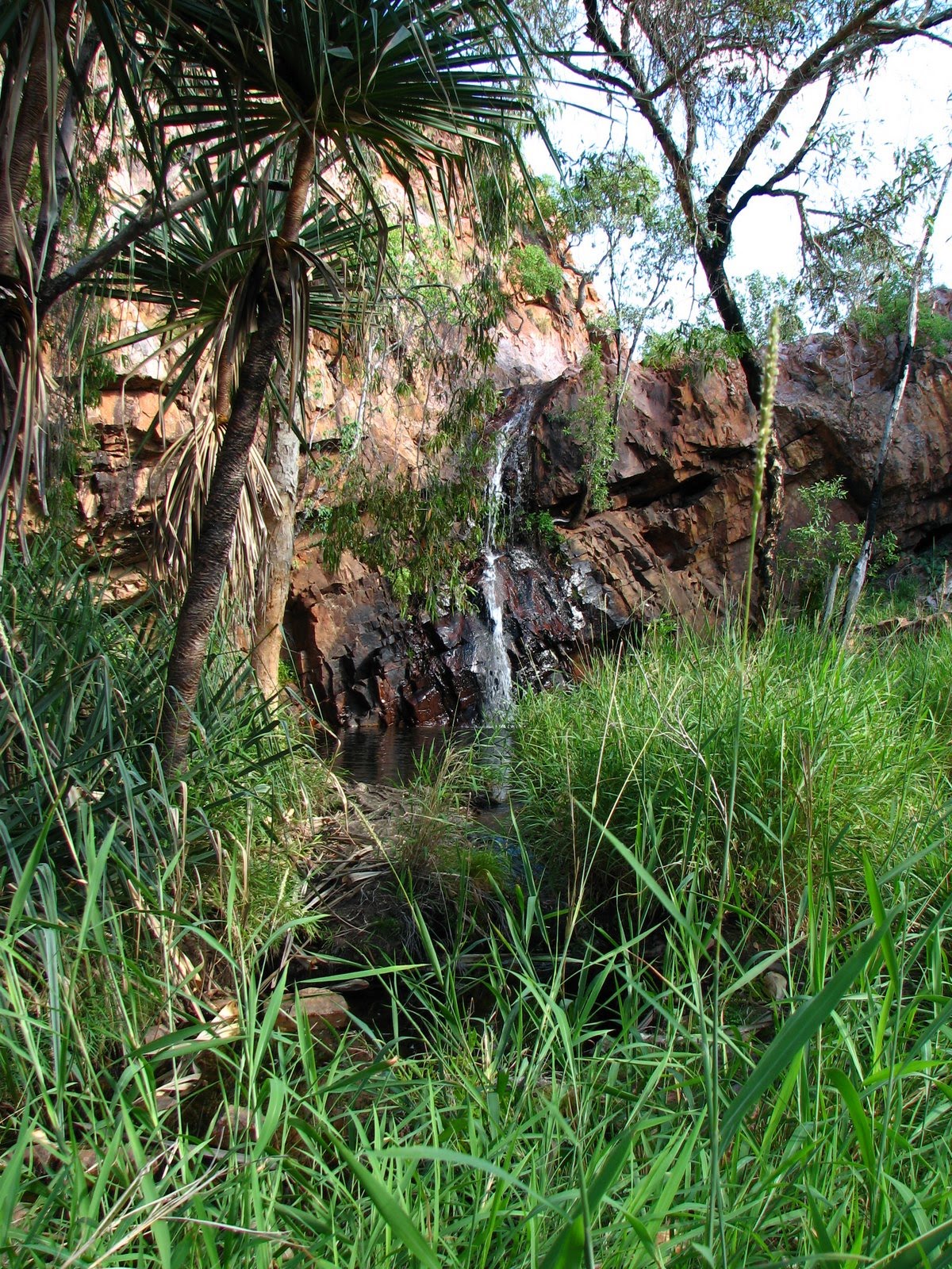
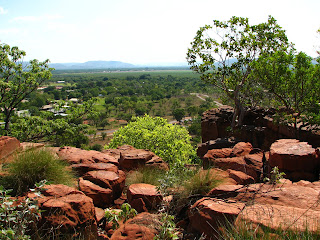
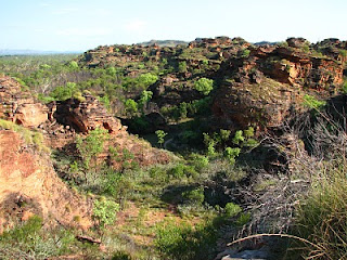
So we elected to spend the morning visiting Mirima National Park (AKA Hidden Valley)(AKA the Mini Bungles). This National Park was located right on the edge of town and its rocky domes had been beckoning us since our arrival. It was surprisingly spectacular, although squeezed into quite a small area. We took a few walks in and around the rock formations, leading to a couple of lookout points over the town and back over the park itself. Unfortunately (although you'd think we would have been used to it by now) it was still very hot (magnified by the effect of the sun heating up the surrounding stone). Nabbed a grand total of 5 geocaches there, though :)


Although it was still pretty early (and we were still operating on NT time - an hour and a half ahead of Kununurra)(meaning we were getting up at what was 4.30 each morning local time), we decided to head on out to Lake Argyle 70km away. We were hoping to find a few more side-tracks to explore along the way, but only really ended up stopping at the bridge over the spillway, as well as a short drive into a cave in the rocks (which was covered by too many spiderwebs to consider further exploration). Close by to the lake we also drove into Dead Horse Springs - made memorable by the fact that this was where I succumbed to the temptation to drive at high speed through a big, muddy puddle. Unfortunately, it turned out to be pretty stagnant, and the distinctive odor given off by the generous coating of mud over the BT served as an ongoing reminder to steer around any subsequent puddles (I did try to float the idea of driving through a bigger puddle in an attempt to clean off some of the mess, but was vetoed by Ryan).

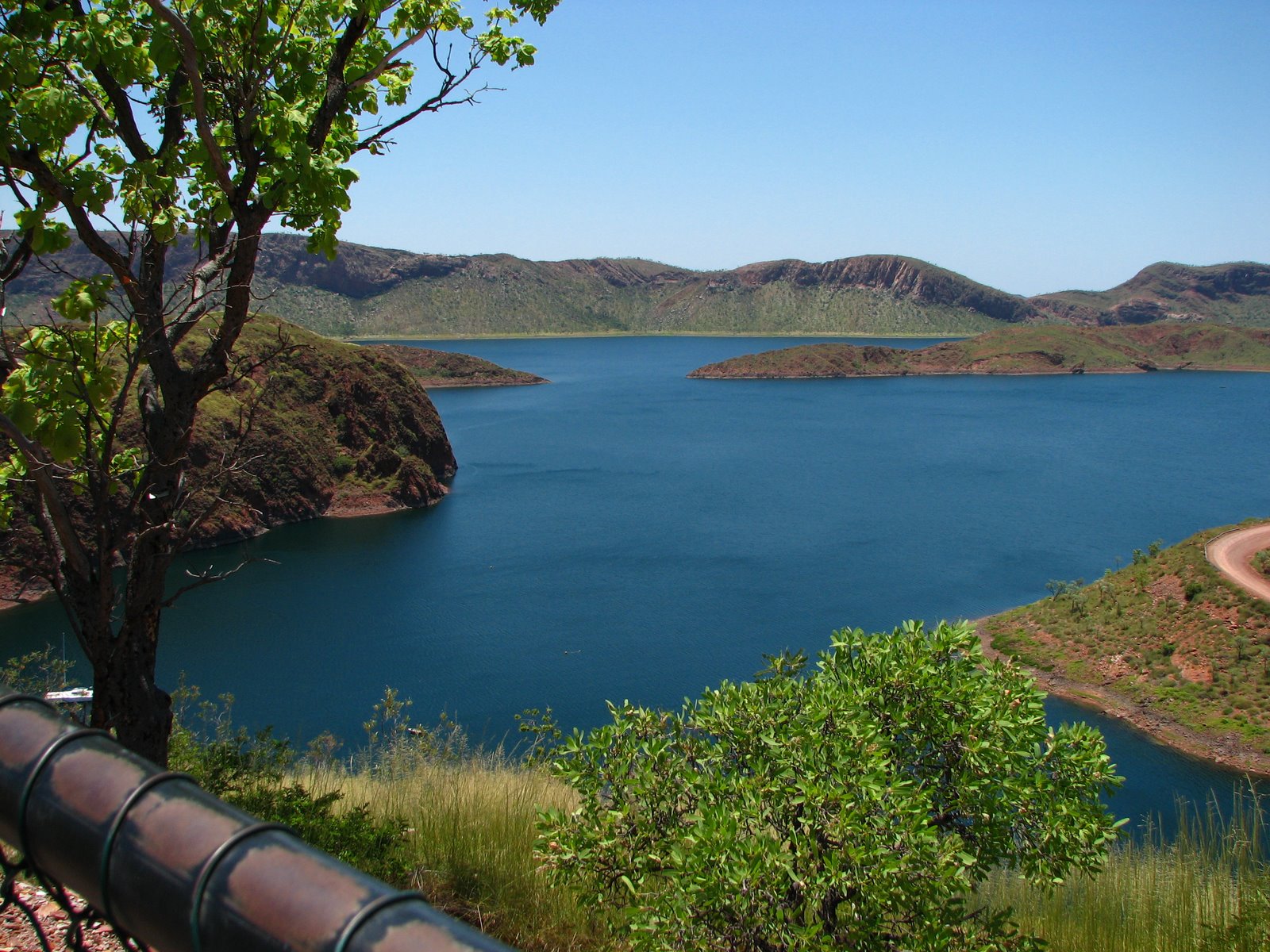
Anyway, we finally made it to the Lake itself, which was spectacular. The huge expanse of deep blue water stretched off into the distance, in contrast to the red rock of the surrounding hills. After enjoying the view, we spent a lazy couple of hours in the shady picnic ground waiting for our cruise.


We ended up sharing the boat with only 7 other people. Our guide and captain was very friendly and down to earth, and offered plenty of interesting information about the Lake and its history. We stopped periodically at various points along the way - our first stop to see some of the rock wallabies, which came right down close to the boat to accept a feed of horse pellets.


We also stopped in a small bay to feed a horde of catfish - these went into a frenzy when the guide shook a bread roll around in the water in their midst (he even had one attached to his finger when he brought his hand back up). Right next to us, there was a fresh water croc with a handful of babies crawling in and out of the water around her. Apart from one hiss and snap, she just sat motionless and wary in the water while we entertained ourselves with the fish.


At one point, we also cruised right down into the midst of the Lake to get a true appreciation of its size. With the water stretching beyond the horizon, it felt almost like we were heading out to sea.


The cruise ended with us mooring in a sheltered bay for a swim and to watch the sun set. The water was amazingly clear and clean, and we spent a tranquil half-an-hour or so watching the last rays of the sun disappear behind building stormclouds.


As we were heading back to Kununurra we came across a vehicle stranded on the side of the road with its occupants waving for help. A quick debate as to whether it was safe to stop or not, soon had us turning around to see what the problem was. It turned out to be a couple of members of the support crew for "Pedals for Prostate" - a bunch of fireman riding around Australia in order to raise money and awareness about prostate cancer. They had been driving with the fuel light on for the past 100km, and had finally run out of diesel only 30km from Kununurra. Unfortunately, although we were carrying two jerrycans, they were both empty. Instead, we cleared some space on our backseat and gave one of them a lift into town to seek out the rest of their group (who were all happily on their way to being drunk in the local pub by then).

After finding the remainder of the township pretty much dead by then (only about 8.00 at night), we bought some Chinese food at the only open shop and returned gladly to our campsite and beds.
Posted by Picasa

Wyndham


Our plan for Wednesday was to drive up to Wyndham. Although a few people (including a random tourist in the caravan park swimming pool) had told us that it wouldn't really be worth the drive, it actually turned out to be one of the best days we had away.

We started off by taking another unmarked track from the highway to a place called Molly Springs. Given the lack of signposting, it was surprising to come across a very well-made picnic area complete with tables and BBQs at the end of the track. It looked like quite a popular spot with the locals, but we had the place completely to ourselves. A short walk up the creek ended in a shaded grotto with a cascade of water falling into a crystal clear pool at the bottom. It was a truly beautiful spot, and probably one of our favourite places of the trip (made better by the fact that it was very much off the beaten track).

We continued further north up the highway, with another stop at the Grotto. This was a deep gorge cut into a rocky hillside. It took us a bit of hunting to find the steps leading down to the base, but eventually we made it to the pool at the bottom. The falls themselves were dry, but the shady water was another oasis from the heat. We saw a couple of water monitors swimming about and sunning themselves on the rocks, and rested a bit to watch and photograph them before ascending back into what felt like a furnace up above.


Then it was on to Wyndham. We spent time exploring every "attraction" the town had to offer. These included the "Big Croc", which, not unsurprisingly, was indeed a very big croc. We stopped briefly at the pioneer cemetery which was mostly filled with the graves of workers who died during the construction of the meatworks. A bit further down the road was the Port of Wyndham itself - not much to see there, and a bit of a mystery as to where the water itself was (so far we had only seen mudflats as we were driving down). We also sought out the Dreamtime Statues - giant sculptures of an Aboriginal family and assorted animals (these were actually quite well-done and an impressive sight).


And last of all we drove up to the Five Rivers Lookout - the main reason most people visit Wyndham. This very much lived up to its reputation - giving expansive views down over the township and the huge tract of water that we had been unable to see from lower down. Lots and lots of photos :).

From there, we headed back out of town to check out Parry's Lagoon. Along the way we stopped at the old telegraph station - a collection of ruins perched above the river and swamplands below. The main station building had been relocated to Wyndham, leaving one chimney and all the footings behind.


Then we drove down to Marlgu Billabong. There was absolutely zero shade to park in, but a short boardwalk led to a birdhide where we sheltered for a while. Unfortunately most of the birds had taken off in a huge flock as we approached, but we still spotted some ducks and geese and a couple of brolgas on the far bank. No crocs though (not that we could see anyway...)


Then we decided to take a drive down the Old Halls Creek Road. The road itself was the original stock route from Wyndham to Ivanhoe Station (close to Kununurra), and had been built with convict labor back in the 1890's. They laid kerbing stones both sides and filled the centre with gravel to create an all-weather road. Most of the kerbing stones were still visible (impressively) along the entire length of the track. They looked neatly and carefully laid - must have been a huge (and very hot and hard) job. We stopped briefly at the site of an old stock camp, where there was also an old stone watering trough built the same way.


A couple of other diversions down sidetracks led us to a Lily-filled billabong, as well as the "Croc-hole" - a large pool of greenish water that could well have hidden a few residents of the reptilian kind.


The road eventually joined back with the Highway, and from there we had an easy drive back to Kununurra. Our day was complete with a swim in the caravan park pool, then watching the sunset over the lake. After the previous largely sleepless night, we also decided to try sleeping in our backup tent (my old lightweight hiking tent brought along in case of rain - newer and more waterproof, but also much smaller). We left the fly off and slept under the mesh alone, and managed (with the aid of a coolish breeze) to actually get some sleep (although Ryan's toes protruded through the zip during the night and let in a bunch of mozzies)(he scored one large bite under his toes which drove him crazy for the remainder of the trip)(true to form, I already had dozens by then).
Posted by Picasa

Saturday, November 13, 2010

Keep River National Park

Our plan was to get up early and do some exploring in the park before it got too hot. Unfortunately, by 8.00 in the morning, it was already getting uncomfortable.


We elected not to do the 8km hike that started from our campsite, but drove a bit further south to the Jinumum (Keep River Gorge) Walk. The gorge was very much dry (and very, very hot with the sun beating down off the rock above us). It ended at an Aboriginal Rock shelter which sported a few paintings - although all of these looked pretty recently done (or painted over). It was all a bit uninspiring. It was made slightly more worthwhile when we detoured up a faint, unmarked track on the way back that led to another shelter with some better art (although also looking painted over) and a grinding stone lying underneath.


Braving the heat, we decided to try another walking trail - this time the Gurrandalng Walk leading from the other campground in the park. This was a much more interesting walk - winding through and over "beehives" of sandstone, similar to the Bungle Bungle formations. It also gave expansive views over the southern part of the park and a much better appreciation of the landscape (which was less than impressive from the limited vantage gained while driving). I had been beginning to wonder what the attraction of the park was, until I experienced the amazing rock formations seen on this walk.


Our last stop in the park was Cockatoo Lagoon, with its promise of shade and abundant birdlife. Unfortunately it was more mud than lagoon, but there was still an assortment of ducks, geese, and brolgas to attempt to photograph.

Then we headed on into Kununurra. Our first mission was to restock the ice in our esky (turned out to be not quite up to the heat), then to find somewhere to camp for the next few nights. After a couple of laps of the main drag, we chose Kimberleyland - a caravan park on the edge of Lake Kununurra which seemed to offer the most chance of shade. Then we took off for some more exploring.

We checked out the Zebra Rock Gallery first - a showcase of all sorts of things carved from the local Zebra Rock, from vases and bookends to ornaments and jewelry. Didn't end up spending any money though :).

We also had a quick look at the "Swim Beach" - a park and boatramp just underneath the Ord Diversion Dam. The water was tantalizingly clear and cool, but the threat of crocs kept us strictly on dry land.

Then we made for the famous Ivanhoe Crossing - a long causeway built over the Ord River. We stopped for a while to ponder the safety of driving through the fast-flowing water, all the while observing a family of Aboriginal kids swimming at the edge and a fisherman knee-deep at the far side, all seemingly oblivious to the very real threat of salt-water crocs. Not to be outdone by a bunch of backpackers in a rented 4WD, Ryan finally made the drive across only to discover a short bridge of land and then a second crossing out of view on the far side. Having passed the point of no return, this was also conquered without any of our party (person or vehicle) drowning (thankfully).


Guided by our GPS, we then went to seek out a few more un-signposted landmarks by way of searching out the geocaches hidden at each (turns out to be a very good way of discovering things that aren't always advertised to tourists - there is a geocache at pretty much every point of interest up there, and each one often contains a good description of the particular landmark and often the history to go along with it).

We struck out on an unmarked dirt road through a herd of cattle to find Black Rock Falls. This was only a trickle, with a big, sluggish pool of water at the bottom, but the streak of wet, black rock amidst the otherwise red landscape explained the name.


There was another track leading from the falls in vaguely the direction we wanted, so we decided to do some more exploring, and after a little creative 4WDriving, actually managed to end up where we intended - Middle Springs. There was a big pool of water here, but it was stained a dark tannin-brown, so we resisted the temptation of a swim. Nabbed another geocache though :)


Then we headed back to town (which involved another trip over Ivanhoe Crossing - my turn this time), and drove up "The Knob" - a big rock outcrop rising from one edge of town which offered stunning views over the surrounding countryside. From here we could appreciate all the farming land surrounding the town, supplied by irrigation from the Ord River. We were, again, surprised at how green everything was.


And finally, we headed back to the caravan park and set up camp. Our front yard was a stretch of lush green grass leading to the edge of the lake and a view directly over to "Sleeping Buddha" - another rocky outcrop on the far side. It was a beautiful spot to sit in the shade and watch the antics of the swamp hens. Unfortunately, it was stifling hot inside the tent, and neither of us got much sleep that night.

Posted by Picasa

Through Timber Creek


From Katherine, we headed west. Gradually, the scenery changed as more and more rocky outcrops began to rise either side of the road. We stopped in Timber Creek to top up on diesel and take in some of the countryside.


A few kilometres out of town we drove into Policeman's Point - a high point overlooking the Victoria River. Ryan managed to spot a croc sunning itself on the gravel below (I missed it while I was searching through the truck for my hat)(turned out to be already on my head)(sigh). I took a random photo of a bird resting in the shadows on a distant branch - after looking at the photos properly at home, I discovered that it was actually a rainbow kingfisher - quite a beautiful bird.


We took another detour up to Telecom Hill which offered expansive views over the river and township below. The countryside was surprisingly green. We figured there must have been a decent amount of rain in the preceding weeks, although to us it was very much hot and dry, with nothing but clear blue skies.


We had a brief lunchstop at Big Horse Creek - a camping ground and boat ramp down alongside the river. Venturing out onto the boat ramp gave a good view of the Bradshaw Bridge - made "famous" in our minds by my parent's story of having walked across to the locked gate on the other side (leads to Bradshaw Field - a military training area) and randomly meeting a relative of a friend back home in Parkes. Small world...

We were also on a mission to see Gregory's Tree - a big old boab inscribed by Augustus Gregory, an explorer who led an expedition to the "interior" from Brisbane in 1854. The tree marks one of their basecamps from which they explored the Victoria River and traced Sturt's Creek for 483km until it disappeared into the Tanami Desert (impressive). We were quite surprised (after seeing plenty of photos) at how big the tree actually was in real life. It was all fenced off with a viewing platform along one side, so no chance of standing next to it for a bit of perspective. It also had us pondering whether in another hundred years people would come to see the many other boab's inscribed by passing tourists alongside the highway (come see "Shazza's" tree...).

From there, we drove the rest of the way to Keep River National Park and set up our first campsite for the trip. Far from our fears of rain, the biggest problem we encountered was the heat. We didn't know it at the time, but this first sweaty night would turn out to be the coolest of our trip (sigh).

Posted by Picasa

On the road again...

Sorry about the recent lack of posts - something to do with having one weekend off for the whole month of October...

Anyway, my much-awaited two weeks off has finally arrived (one week for Ryan), so we decided it was time to do some more exploring. Funny how whenever you mention to anyone here that you are having holidays, the immediate question is "so, are you heading out of the Territory?". As tempting as a cheap flight to Southeast Asia sounded, we thought we should see a bit more of the Top End while we were here, so Kununurra and the East Kimberley it was.

It hasn't quite turned wet up here yet, but a soggy camping trip was a definite possibility. Remembering the built-in shower our current tent provided during our trip through Palm Valley, we decided it might be wise to invest in a more water-proof shelter prior to leaving. After visiting all the camping stores in Darwin (all three to be precise) and being very much uninspired by the selection of tents, true to form, Ryan turned to the Internet. We chose an excellent Black Wolf Turbo Tent, found the cheapest one in Australia and had it shipped to Darwin. Unfortunately it arrived the day after we left...

Anyway, after a generous sleep-in (after finishing work sometime around midnight on Saturday night)(started an operation ten minutes before my 14hr shift was due to end, and once you're in, you're in...), we left Darwin late on Sunday and headed towards Katherine.

We had been wanting to see Katherine Gorge since speeding past it on our original trip up here, so we pulled in and booked onto the last remaining cruise for the afternoon. There was some excitement for Ryan when a couple of prototype Ford Territories pulled into the parking lot. They had black plastic moulding and paintjobs in distorting geometric designs so you couldn't tell their true shapes, and were flanked by an armada of various other Fords. Their crew of indoorsy-looking engineers joined us for the cruise, but not before moving the vehicles to a more isolated parking lot and covering them over. If only we had have been brazen enough to take some photos...

The gorge itself was pretty impressive. The whole system is split up by rockbars which divide it into a series of smaller gorges - our cruise was only up the first two, with a walk past some Aboriginal rockart in between. We also managed to score an extra guide who accompanied a tour group and repeated over the microphone everything the Aboriginal guide said in German.

The gorge was very open to begin with, but gradually the walls got higher and closer together, and the scenery got more impressive the further up we ventured. I would have loved to have hired a canoe and gone exploring, but the heat was oppressive, and Ryan is hard to convince at the best of times :).

We decided to treat ourselves to a motel room on our first night (the lure of air-conditioning), and spent a restless night stressing over all the camping gear in the back of our ute getting nicked (the town has a bit of a reputation...)


Posted by Picasa